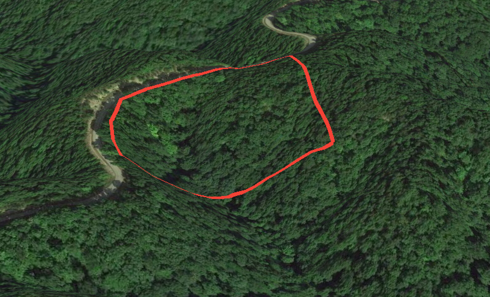
I recently came to terms with this gentleman on his 5.2 acre parcel for $2,700 plus closing costs. I spoke with a man at the courthouse and he said that property is really selling there right now and ranges from $1,400-4,500 per acre. However, after looking at the property, it is evident that a vast majority of it is steeply sloped and probably unusable. I have to call and figure out the zoning as well. Would you do the deal?
Hard to say without knowing the area and some more details. Personally, I wouldn't make a decision just on Google Earth's 3D terrain view. It might be worth calling a builder in the area who has experience building on hilly terrain and seeing what they have to say.
1 Like
@kayarbe I would say buy it depending on a title check. $2700 total or $2700 pa?
If that's total, I'll buy it if you don't.
Assume you're all in for $3500. You get $1000 down and $200 a month for 24 months and you're +40% IRR. That's worth doing in my eyes. $100 over 36 months is 17%...Thats about your floor. I don't see how you couldn't sell it for a profit if the per acre prices hold and you pull up the monthly and push out the duration.
@kayarbe second...do not for a second trust google earth for slope and gradient. If you PM me the location I'll get it on a topographic map for you that will really help you understand the way the land lies.
@Cory you can add topographical layering from earth point onto google earth
It all depends on comps.. also from the looks of it, the back end seems to be at or above road level to where someone could put in an access
@jawollbrink Yes you definitely can do that. There's some other tools that I have access to (mining and minerals engineer) that give insights well beyond the regular contours.
This is ground reflective radar rendering that can see through the canopy of trees to show ground features an air photo can't show. This is Maramec Spring fishing park in Missouri.
This is good for showing those detailed features, but you can't see some large features, such as the power cut that runs through the top of the photo in the satellite view.
What's interesting is that you can barely make out a trail at the top between the hay field and the timber along the tree line that drives down toward the power cut but you can make it out clearly that it's an access road in the radar rendering.
1 Like
@Cory Nice Cory, Where do you get this mapping?
@jawollbrink I'm searching for a public source where I can help people put this type of thing together and do land analysis Right now the source is from a private GIS platform.